Historical Maps
There are many map services on the internet that provide their maps as a stand-alone image or using a standard tile service protocol. The Running Reality app can load these maps into a layer.
Overview
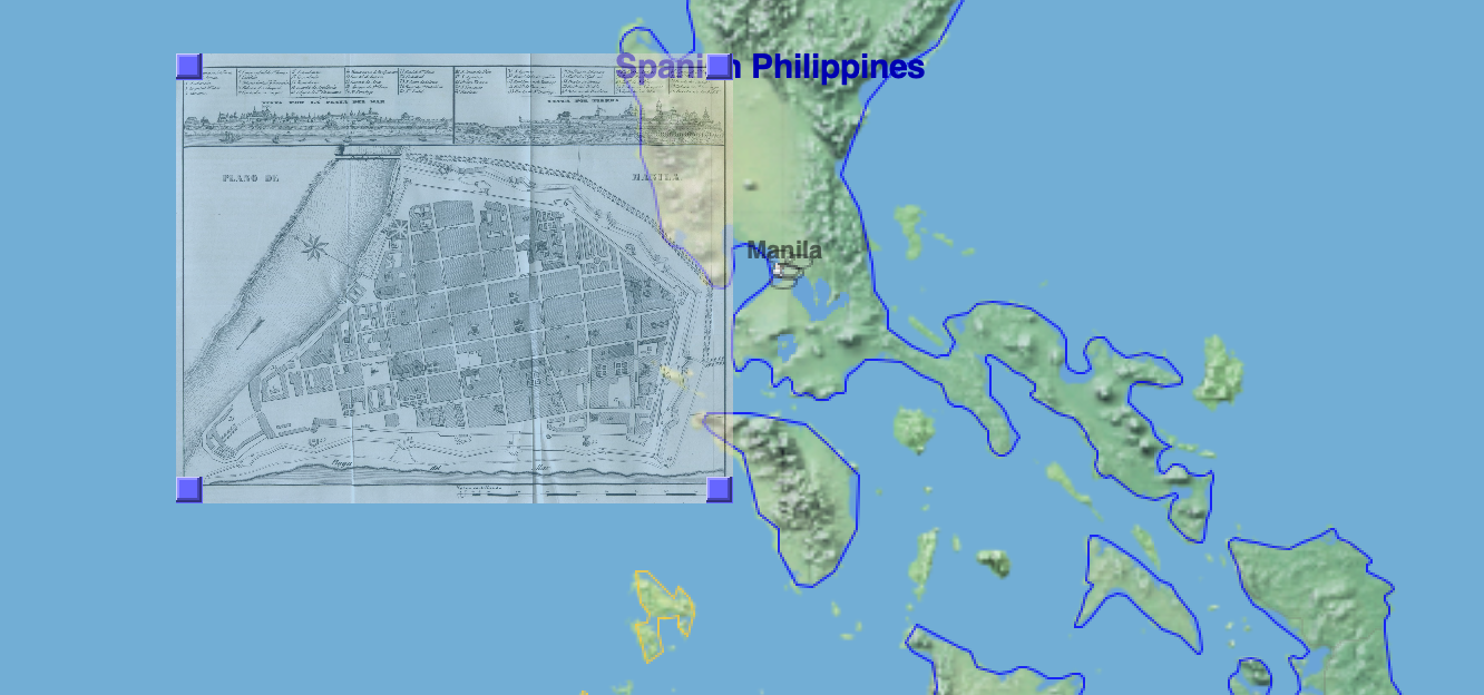
There are online map collections on the internet that provide historical maps as either standalone images (in PNG, JPEG, or GeoTIFF format) or as a map tile service. You can either find them from the Collections in Running Reality's Add Data Source menu or by going directly to their website. For standalone images, you may have to load them and then georectify them yourself.
NOTE Historical facts can not be copyrighted. Running Reality does not incorporate historical maps into its data set directly, but historical maps contain data about historical facts that can be used. The existence of a building, it's location, and its footprint in a given year are historical facts. That a street existed in a given year and that it ran from one location to another are historical facts, no different than if they were written in words. The image of the map can not be directly used, but it can be a guide to locate historical objects using Running Reality factoids, with proper citation of the historical map image.
Collections
These are websites that host individual tiled maps or collections of tiled maps. You can access collections directly from with the Running Reality app's Add Data Source menu or by going directly to the websites below. Care should be taken regarding copyright when doing research with an online map, and proper citations should be used.
| Open StreetMap | Map tile server available for an atlas of the modern world. | |
| Wikipedia | The open online encyclopedia with a wide range of historical maps. | |
| New York Public Library | The New York Public Library has an extensive collection of historical maps. | |
| US Geological Survey | Detailed historical topographical maps of the U.S. | |
| University of Texas | Extensive global map library | |
| MapWarper | Maps from the MapWarper.net georectification tool. | |
| Old Maps Online | Maps from multiple sources, including governments and libraries around the world. | |
| David Rumsey | David Rumsey historical map collection | |
| Library of Congress | The U.S. Library of Congress extensive map collection | |
| Historic Aerials | Aerial maps and imagery of the U.S. | |
| West Point Battle Maps | The U.S. Military Academy's battle map collection | |
| EdMaps | Historical maps collection, mostly for Europe, and links to university map collections. |
Georectification
Historical maps in a PNG or JPEG format are usually just raw scans of the original paper map and do not have any embedded georectification metadata embedded in the file. Maps in the GeoTIFF format often do have georectification metadata. Georectification is the process of marking how the pixels of an image align to latitude and longitude on the surface of the Earth. For modern maps, this can be a fairly straightforward process, but for historical maps there may need to be some more complex warping of the map to align features to modern standards of accuracy.
Feature Identification
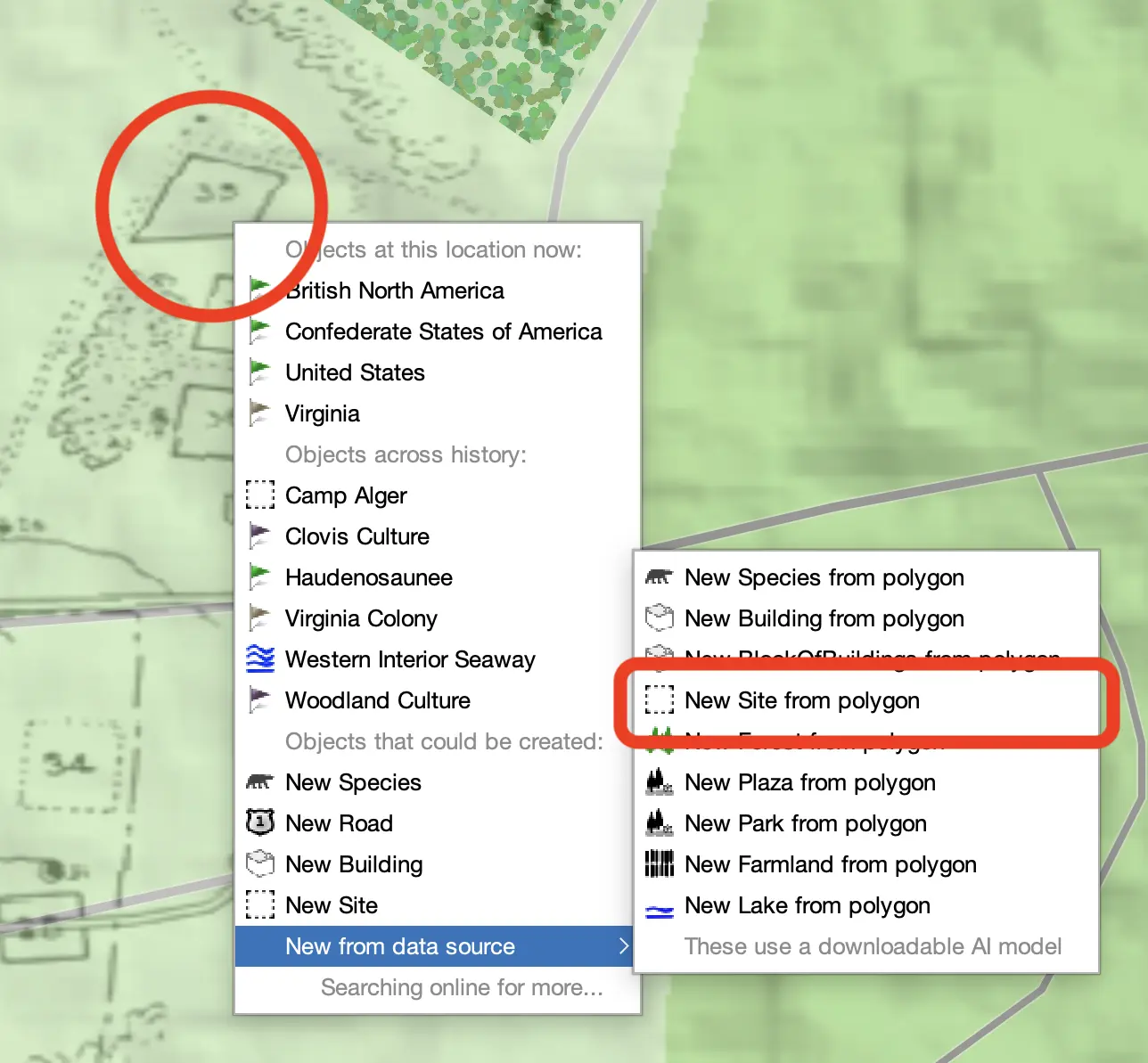
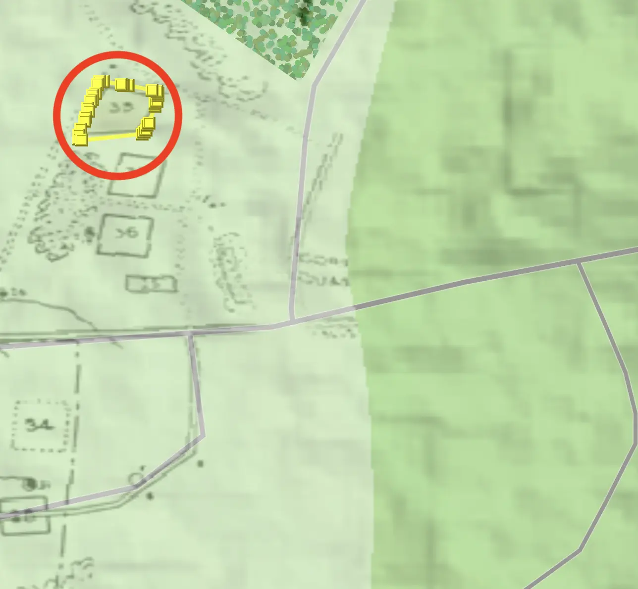
Features in maps that are clear and distinct polygons can be identified and imported using an AI machine learning algorithm. Use the "Identify Features" tool to attempt to pick out a polygon from the map.
Tile Servers
Many historical maps have already been georectified and are available from online map collections as tiled maps. You can provide Running Reality with the tiled map URL in the format below:
| Tile Server | http://[servername]/[path]/{z}/{x}/{y}.png |
| Web Map Server (WMS) | http://[servername]/[path]?request=[getMap|getCapabilities] |
Text in [brackets] you must swap for real URL text, and text in {braces} is for Running Reality to swap for number values.