Custom Historical Map
Add the Running Reality desktop app to your mapping toolbox to edit custom historical map data using our time controls.
Overview
Running Reality has tools that can help you generate your own completely custom historical map. It uses the GeoJSON file format so that you can edit in your favorite GIS tool, such as QGIS, but also use our desktop app's editor for temporal data and to integrate with non-geographic data.
Download AppMany creators of YouTube, Tik Tok, and other videos use custom drawn GIS files for historical nation boundaries. Some use illustration apps to draw the polygons over a fixed basemap image because illustration tools have better temporal controls for animation. Some use GIS apps to draw the polygons because GIS tools have better polygon editors and data layers such as OpenStreetMap for doing alignment and georectification. The Running Reality desktop app has both.
This tutorial will walk you through blanking out Running Reality data, then creating a totally custom animated nation polygon, then exporting that polygon to your other tools. If you don't want to start from a blank map, try this other tutorial here:
A Blank Canvas
Many creators prefer their own research because they are creating very detailed maps of a very specific time period. To use the Running Reality desktop app's tools, and just the tools, without the existing data, first you would prepare a "blank canvas" on which to work.
To blank out the Running Reality data, you will open the app's preferences settings and turn off the visibility of the types you don't want. For most creators this would be nations, provinces, and cultural groups, but not geographic features like rivers, bays, or terrain adjustments.
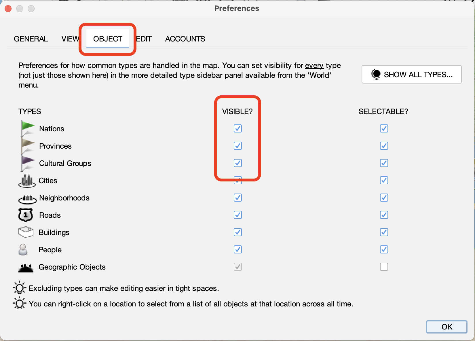
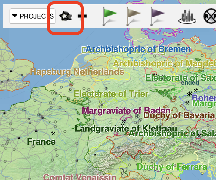
If you want to blank out other types with more precision or to blank out all types, you will use the world data sidebar. If you still have open the preferences panel, you can click "Show All Types" or alternatively you can open it from the toolbar:
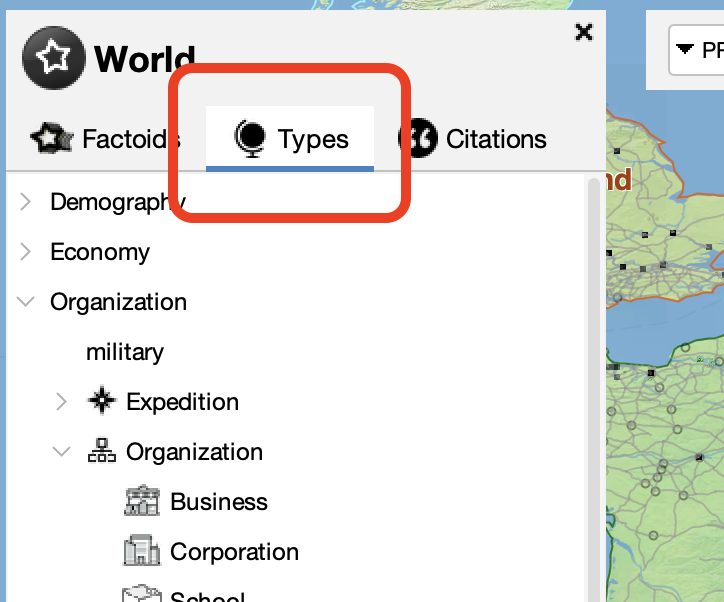
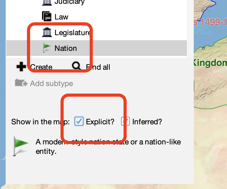
Then, switch to the list of types and select "Nation" from the type tree under Organization/Government:
Turn off the visibility of nations using the check boxes at the bottom of the sidebar:
Now the map should be empty of RR nation data and ready to edit custom nation border polygons:
NOTE While this blanking technique lets you edit your own national border polygons, we would still encourage you to consider using, editing, and contributing to the Running Reality data.
- RR's data model allows date uncertainty. Traditional GIS requires you to pick specific dates for change in polygon visibility, date not supported by source material. These dates aren't data but are inference.
- RR requires citations, which are kept with each element of data so that the accuracy can later be reviewed, audited, or improved.
- You can make edits first in GeoJSON and then import them directly into RR's data. These editing tools were originally designed to make importing data into RR easy.
Creating a GeoJSON File
Now, we will create a new GeoJSON file and populate it with a nation border polygon. The advantage of a GeoJSON file is that you can also load a file you already have populated with borders and you can use any polygons back in your other tools you already use, such as QGIS. Running Reality's desktop app lets you use all our digital history tools, especially the date controls, just for the editing steps that are hard elsewhere. This is a simple tutorial, but you can use the link below for more details.
| Format | Description | File Extension | Usage |
|---|---|---|---|
| GeoJSON | A file with a feature for each location mentioned in the text, with a point geometry and a name property. | .geojson | layer |
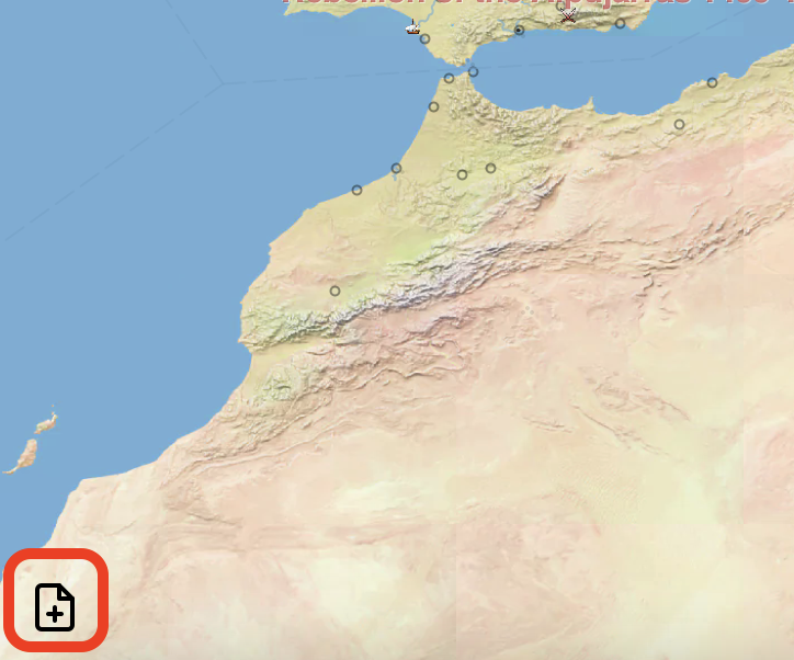
To create a new GeoJSON file, click the add data source button. There is one in the lower left of the map, but also in the World menu and in the toolbar.
Next, select the "From File / URL" tab.
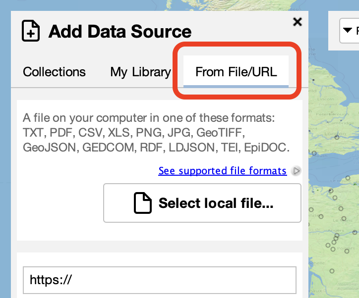
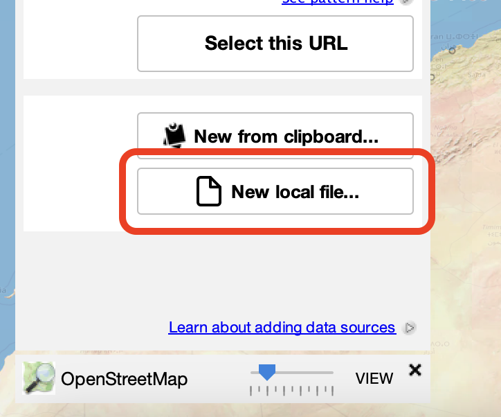
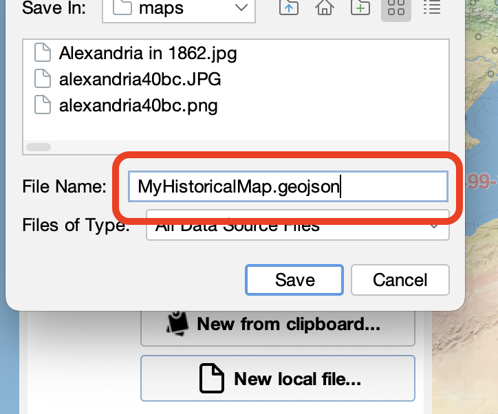
Then, select "New local file..." to create a new blank file.
Enter a filename. Use a filename with the file extension .geojson to create a new GeoJSON file.
Custom National Border Polygon
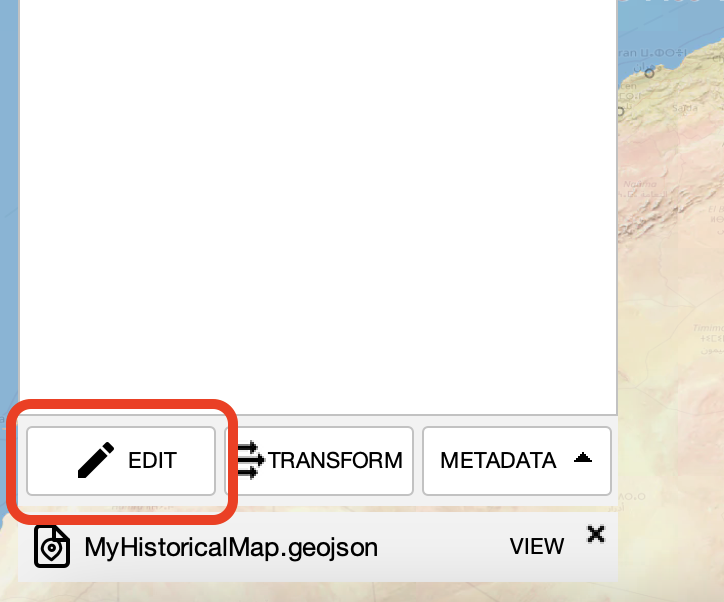
To edit any data source, you must first switch it to "edit" mode. Many data sources are just that -- sources of already compiled historic data -- and shouldn't be edited unintentionally. Click the "edit" button to intentionally edit this file to add data to it.
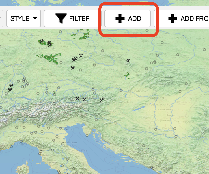
Click the "add" button in the toolbar to add a new feature to the file. A feature can be a point, line, or polygon but it defaults to a point. Edit the feature's geometry and switch it to a polygon.
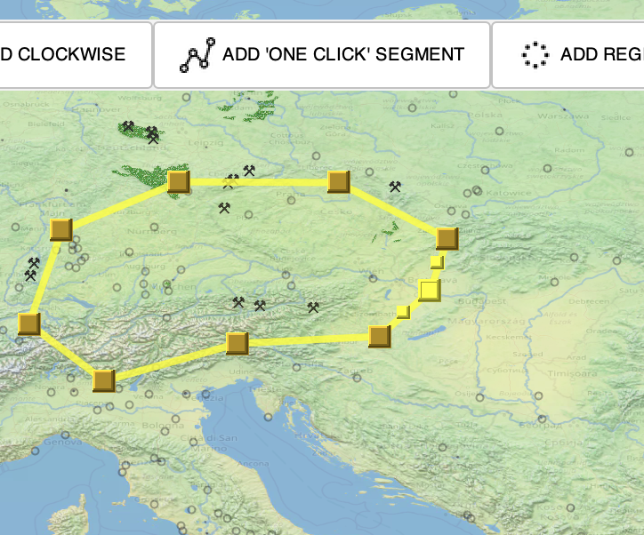
Running Reality's standard polygon editor appears and lets you edit each vertex of the polygon. Advanced editing features like adding a "one click" segment are optimized for tracing historical features, such as from a historical map loaded as a layer from another data source.
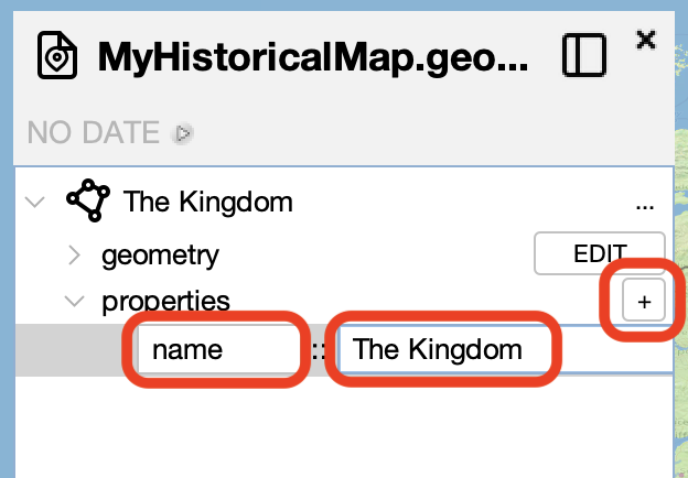
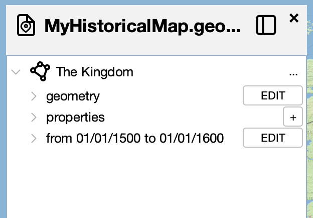
To give this feature a name, add a property to the feature with the name "name". In this example, we name the feature "The Kingdom" since we are creating a national border polygon.
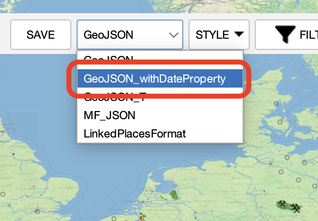
Now, we are going to add dates to this feature. Select the drop-down menu in the toolbar to switch from basic GeoJSON to a time-enabled format. Select "GeoJSON_withDateProperty" to best interoperate with the QGIS Temporal Controller.
Neither GeoJSON nor any other common GIS interchange format has a standard way to handle temporal data. Running Reality supports some uncommon GeoJSON-derived formats (GeoJSON-T, LinkedDataFormat LDF, Moving Features JSON MF-JSON) that do handle temporal data and encourages other tools to adopt them to make them into interchange formats.
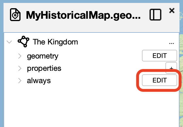
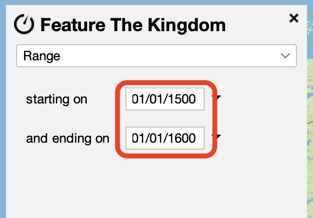
Now, every feature has a "when" attached to it. The "when" for "The Kingdom" starts out with the value "Always." Click the "edit" button to change this to give this feature a specific temporal range.
Switch the date from "Always" to "Range."
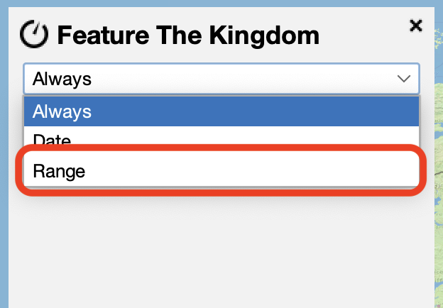
You may now edit the dates when this feature should be visible. The small triangle brings up the standard Running Reality time control. We set the dates to 1500AD and 1600AD in this example.
The feature now only appears when the map date is within the feature's date range. Note that the dates were also synchronized into two GeoJSON properties "startdate" and "enddate" that you can configure the QGIS Temporal Controller to use. If you expand the feature's tree to see the two range dates, they are also clickable links that quickly switch the map date to that feature date.
NOTE Often historical records indicate when a particular territory was in the control of certain nation (like a finding a 1550AD map of "The Kingdom") but not necessarily when the border first had that polygonal extent. Native Running Reality factoid data supports this kind of uncertainty, but a traditional GIS file format like GeoJSON does not. Tradition GIS forces polygons to have improperly precise visible / invisible dates.
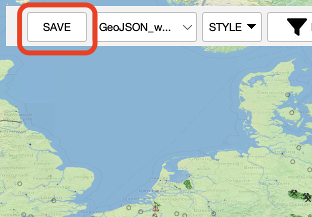
Now, make sure to save the GeoJSON file so that you can use it in other tools.
If you want a copy of the GeoJSON file from this tutorial, you can download it here.
Export
From the share menu of the app, you can embed an image or movie into your own work or just share the image or movie directly. You can copy-paste an image of the map directly to your computer's clipboard. You can create a JPEG image of a point in time or create an MP4 movie or GIF animation of a span of time.
If you want to use this data with another mapping tool that has a broader range of map style and format options, your data is already in the GeoJSON interchange format. This file can be loaded directly as a layer in GIS software (QGIS, ArcGIS) or with Javascript map libraries (OpenLayers, MapBox, Leaflet).
Contribute Data
We could use your assistance to help our team ensure that the latest research can be accessible to our audience. If you were to contribute your data to Running Reality it would be very valuable to the project and would provide citation links back to you, your primary sources, and research material. So, after you create border polygons using Running Reality, we would love for you to consider sharing that same data in the form of factoids.
Feedback
If you can not find an answer here, or would like to request a feature, please feel free to ask us for help. Send us an email if you would like us to get back to you with a response: